
Making use of the good weather we recently tried out a drone flight (UAV) for as part of ongoing R&D into the use of drone technology for recording archaeological site excavations over one of our excavations near completion.
With permission from the land owner we utilised a 3DR X8+ drone fitted with a Canon SX260 digital camera with a wide angle fixed zoom lens. The camera settings were customised to allow for an auto trigger setting for correct image overlapping direct from the drone. Prior to the flight we created a survey boundary outside of which the UAV could not fly and the camera auto trigger was initiated. Total flight time was about 10mins and provided 30 high quality images to work from.
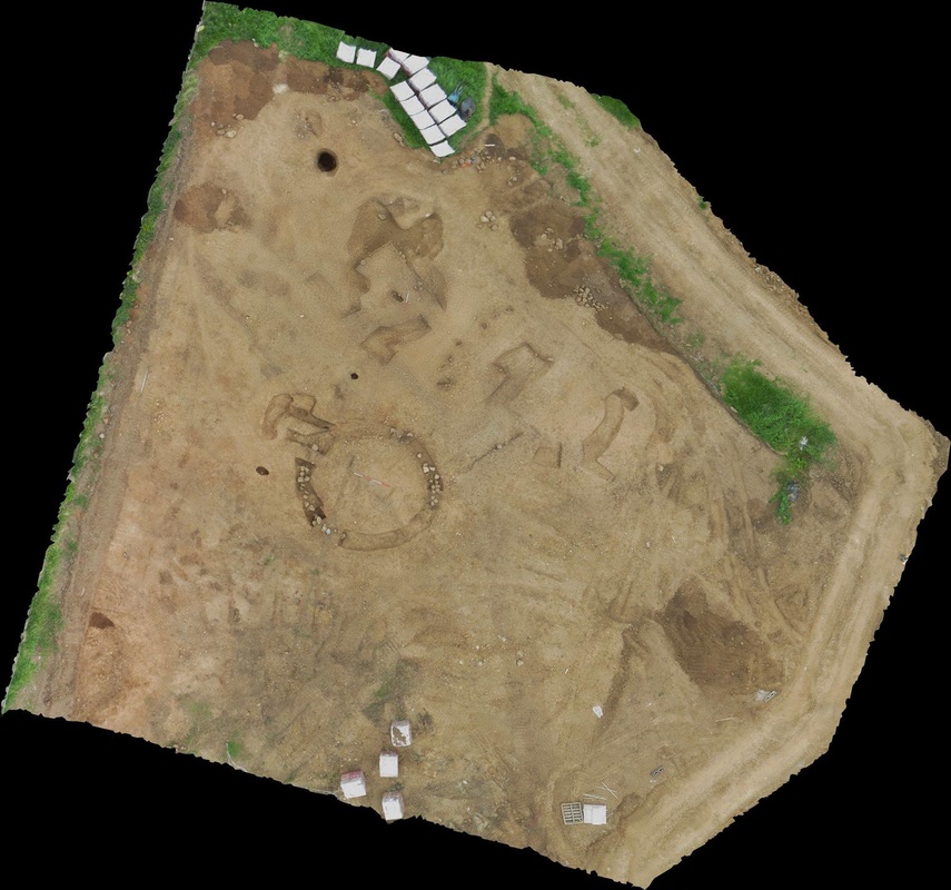
The photos were post processed in VisualSFM and Meshlab open source Structure from Motion with ground targets which were surveyed with our site Total Station. The resulting image below represents a fully scalable and measurable ortho rectified image of the site, with a 2cm ground pixel resolution.
We plan to compare the surveyed image with our traditional digital EDM/GPS site plans. The future of Archaeological site plans? What do you think?
With permission from the land owner we utilised a 3DR X8+ drone fitted with a Canon SX260 digital camera with a wide angle fixed zoom lens. The camera settings were customised to allow for an auto trigger setting for correct image overlapping direct from the drone. Prior to the flight we created a survey boundary outside of which the UAV could not fly and the camera auto trigger was initiated. Total flight time was about 10mins and provided 30 high quality images to work from.
The photos were post processed in VisualSFM and Meshlab open source Structure from Motion with ground targets which were surveyed with our site Total Station. The resulting image below represents a fully scalable and measurable ortho rectified image of the site, with a 2cm ground pixel resolution.
We plan to compare the surveyed image with our traditional digital EDM/GPS site plans. The future of Archaeological site plans? What do you think?
 RSS Feed